Infrastructure in
America
Mapping an Unnatural Disaster
In the spring of 2019, a team of students at the Buell Center working on the "Architecture and Engineering Services" initiative sought to better understand the major players, financing, and timelines of specific architectural projects—University Medical Center New Orleans, Booker T. Washington High School, C.J. Peete Houses, and the Gulfport, MS Transit Center—that were significantly affected by the disaster that has been called Hurricane Katrina. The below research compiles these four students' work through a set of maps that illuminate one neighborhood's changes over time before, after, and over a decade after the storm made landfall. The waterfront of Gulfport, Mississippi is included for comparison in some cases. These changes—in demographics, development patterns, and the privatization of public goods and services—illustrate how slow moving, and unnatural, the disaster has truly been.
Demographics
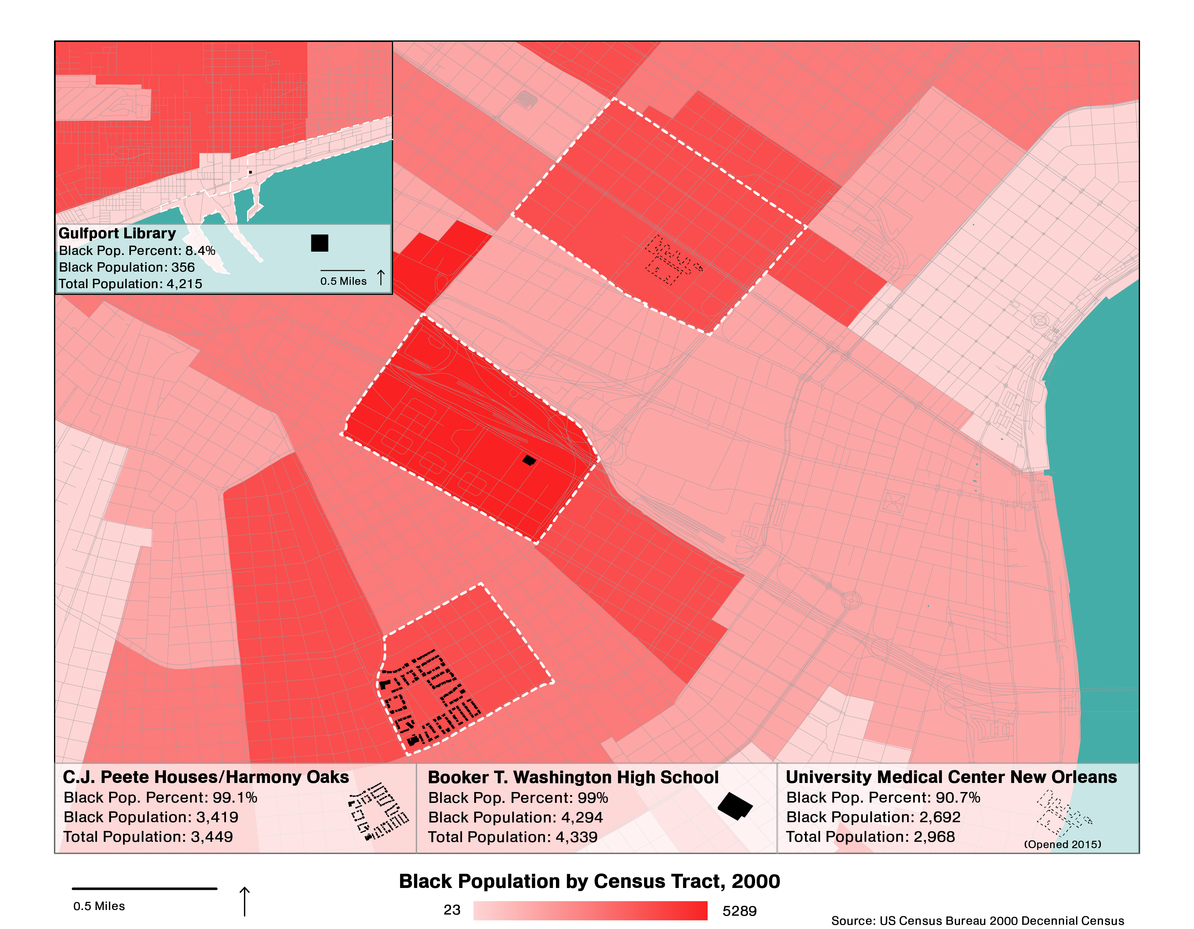
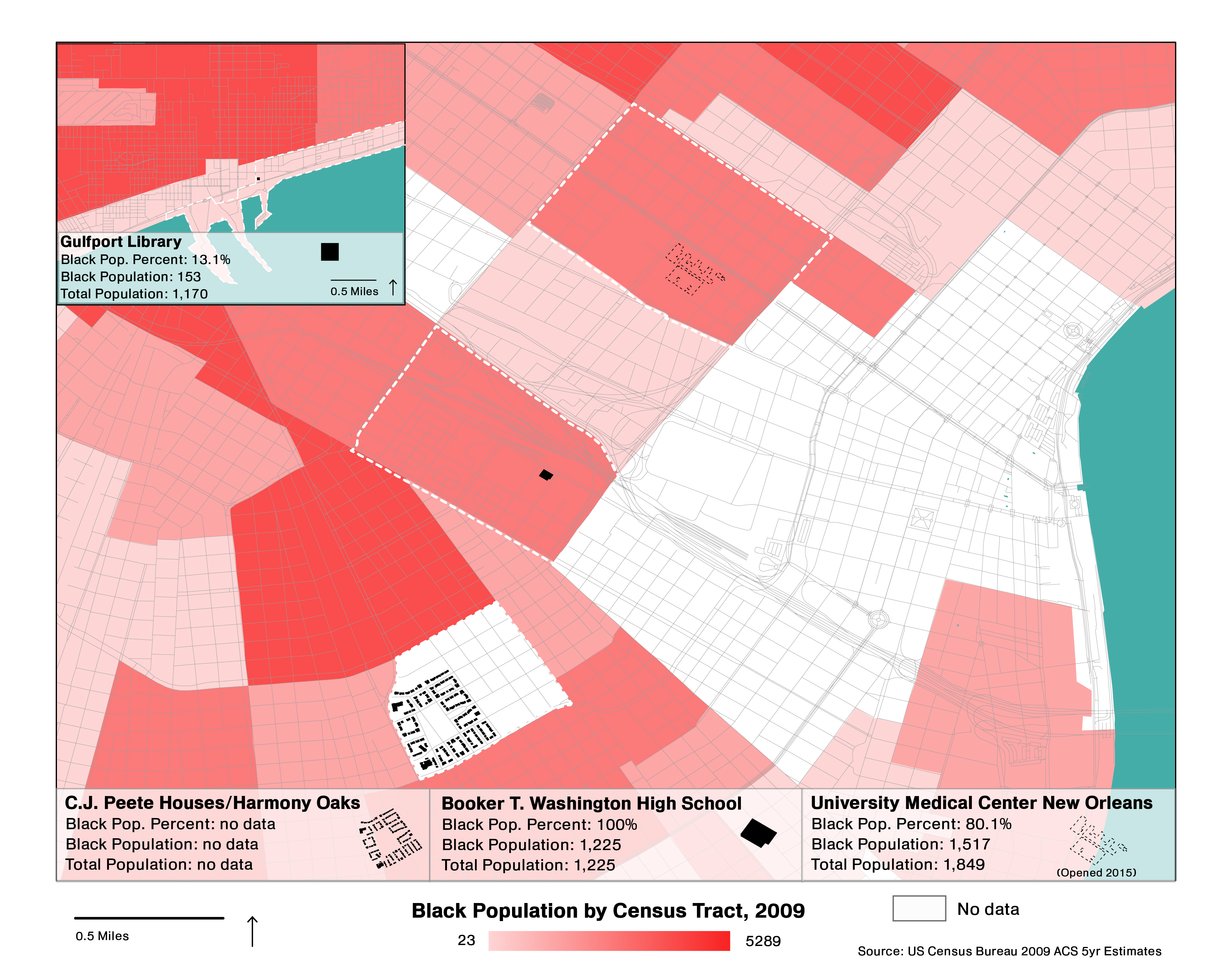
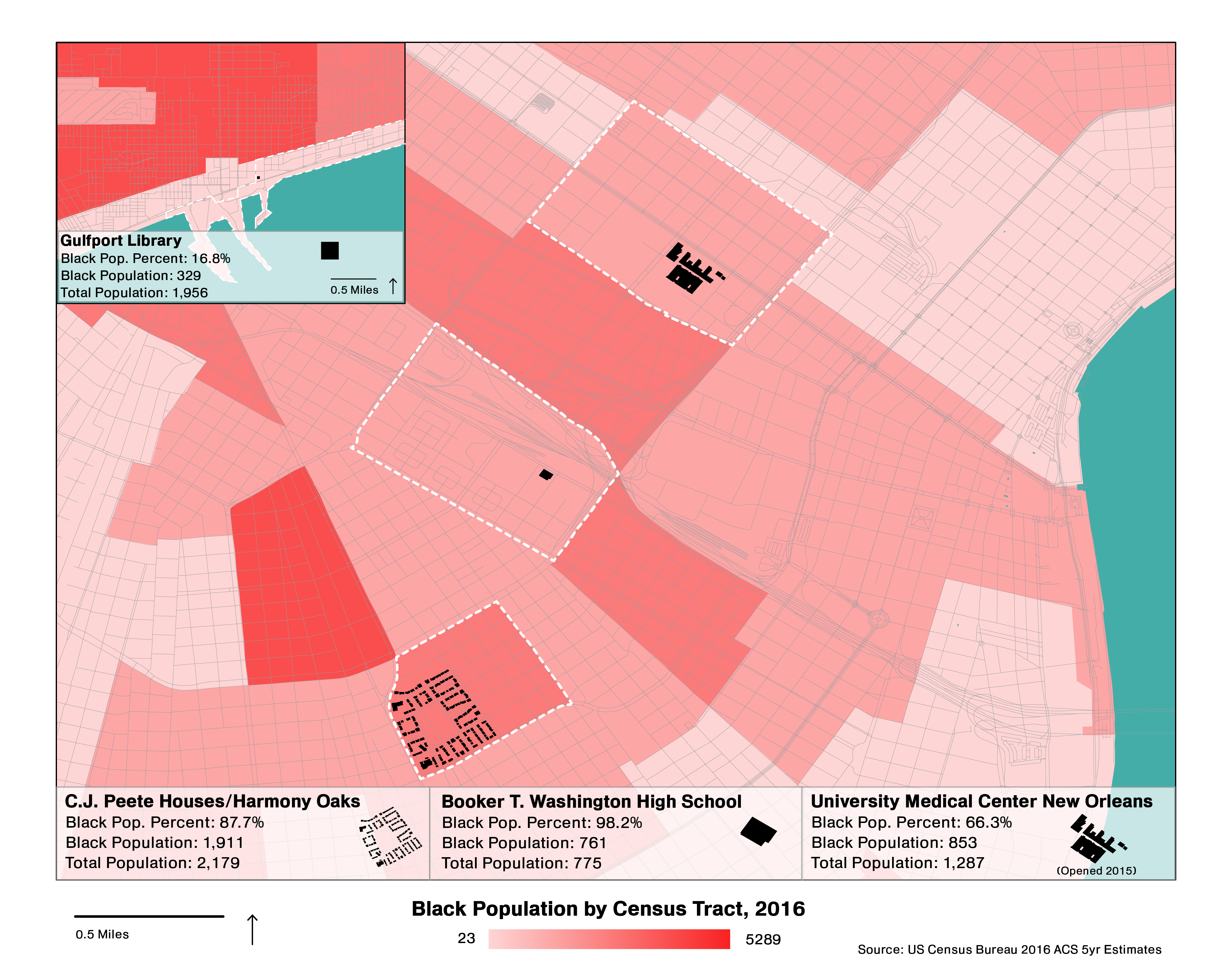
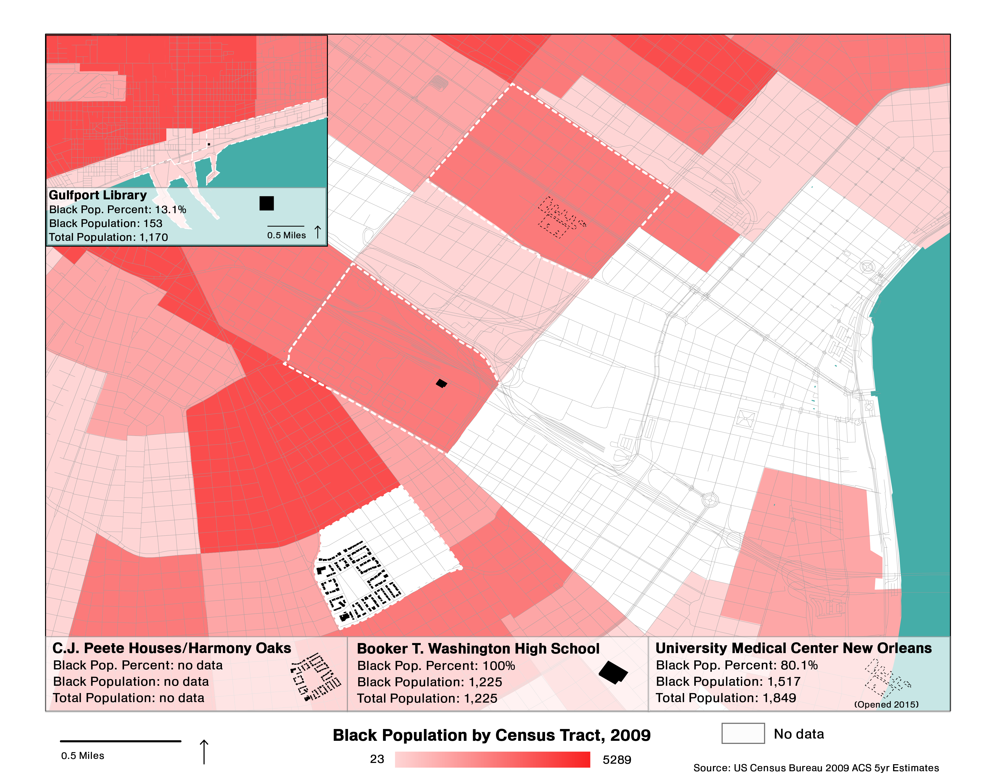
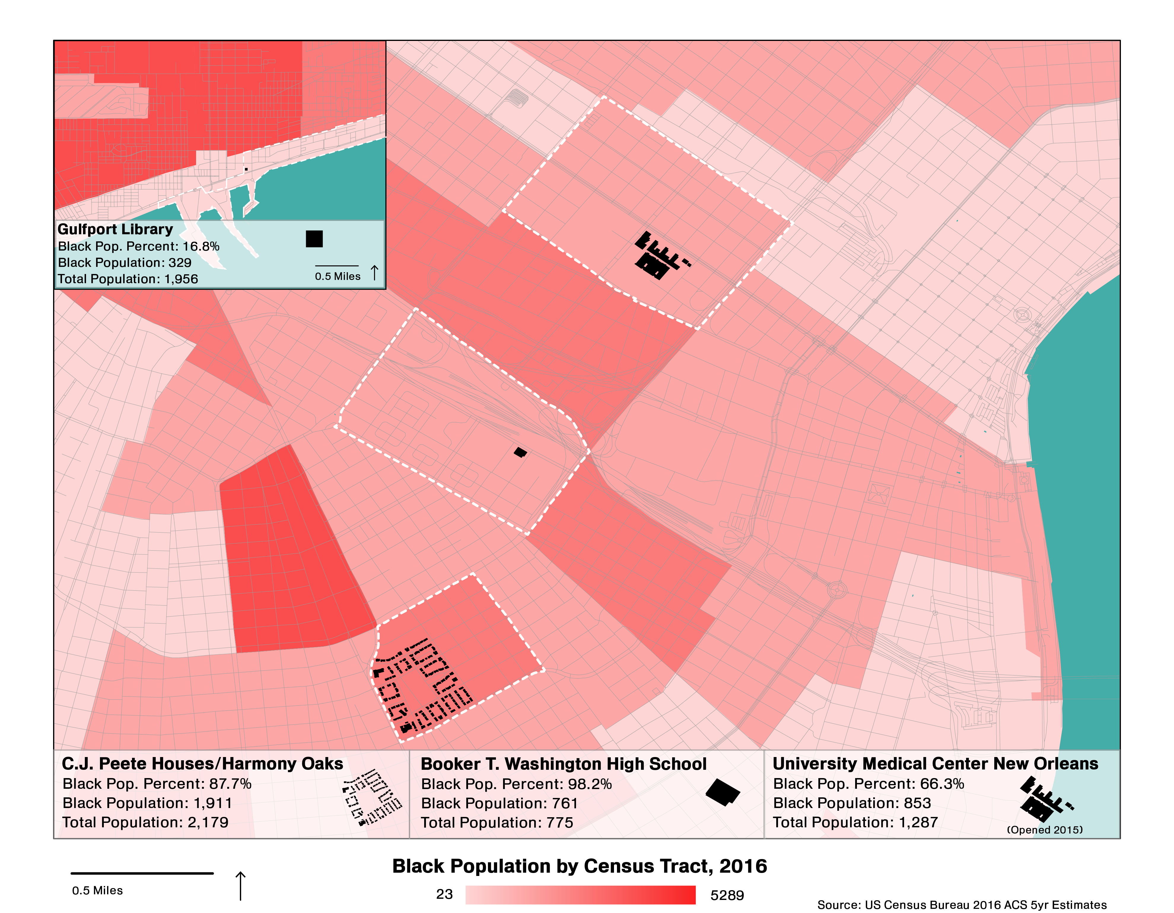
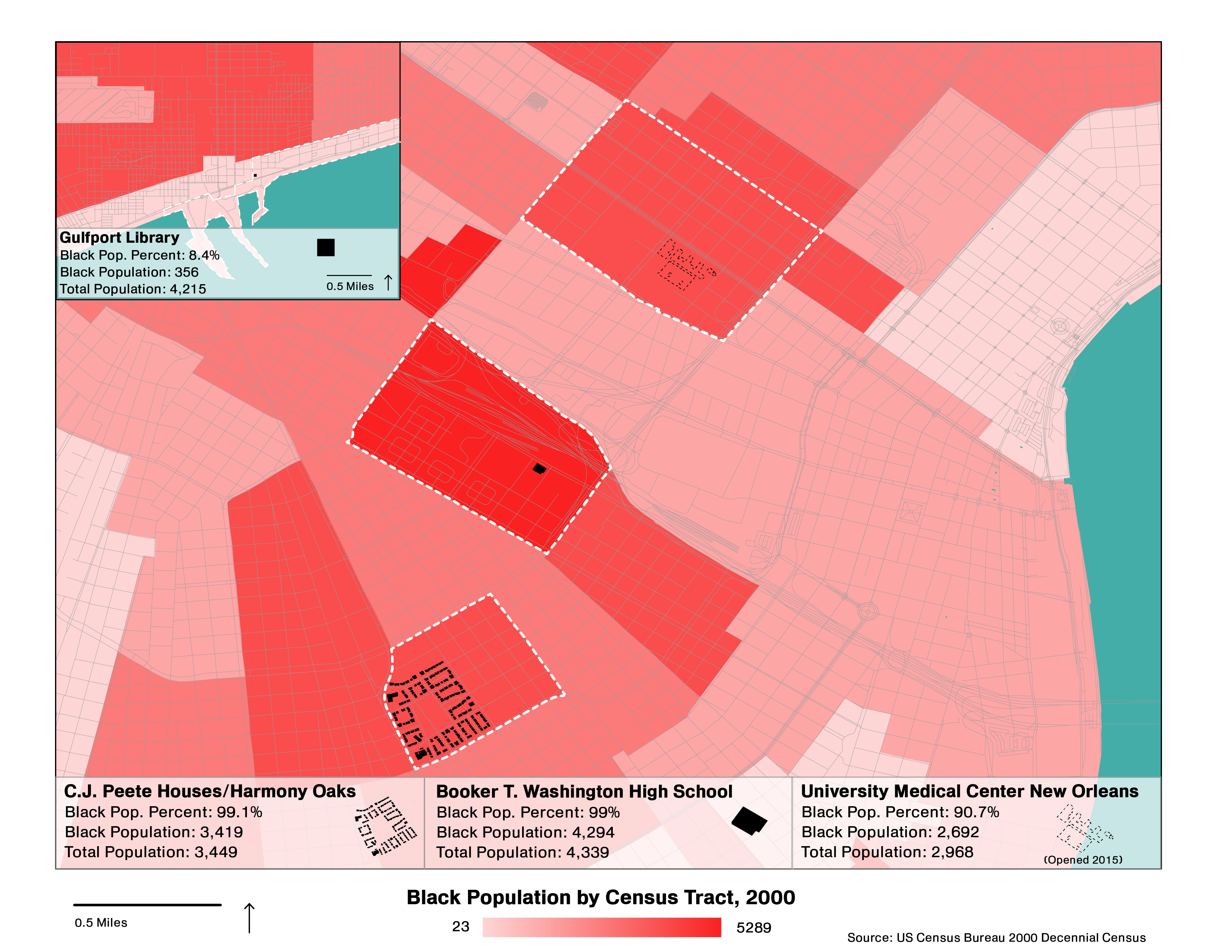
The Black population of certain Central New Orleans census tracts decreased dramatically between 2000 and 2016, mirroring citywide trends.
Schools
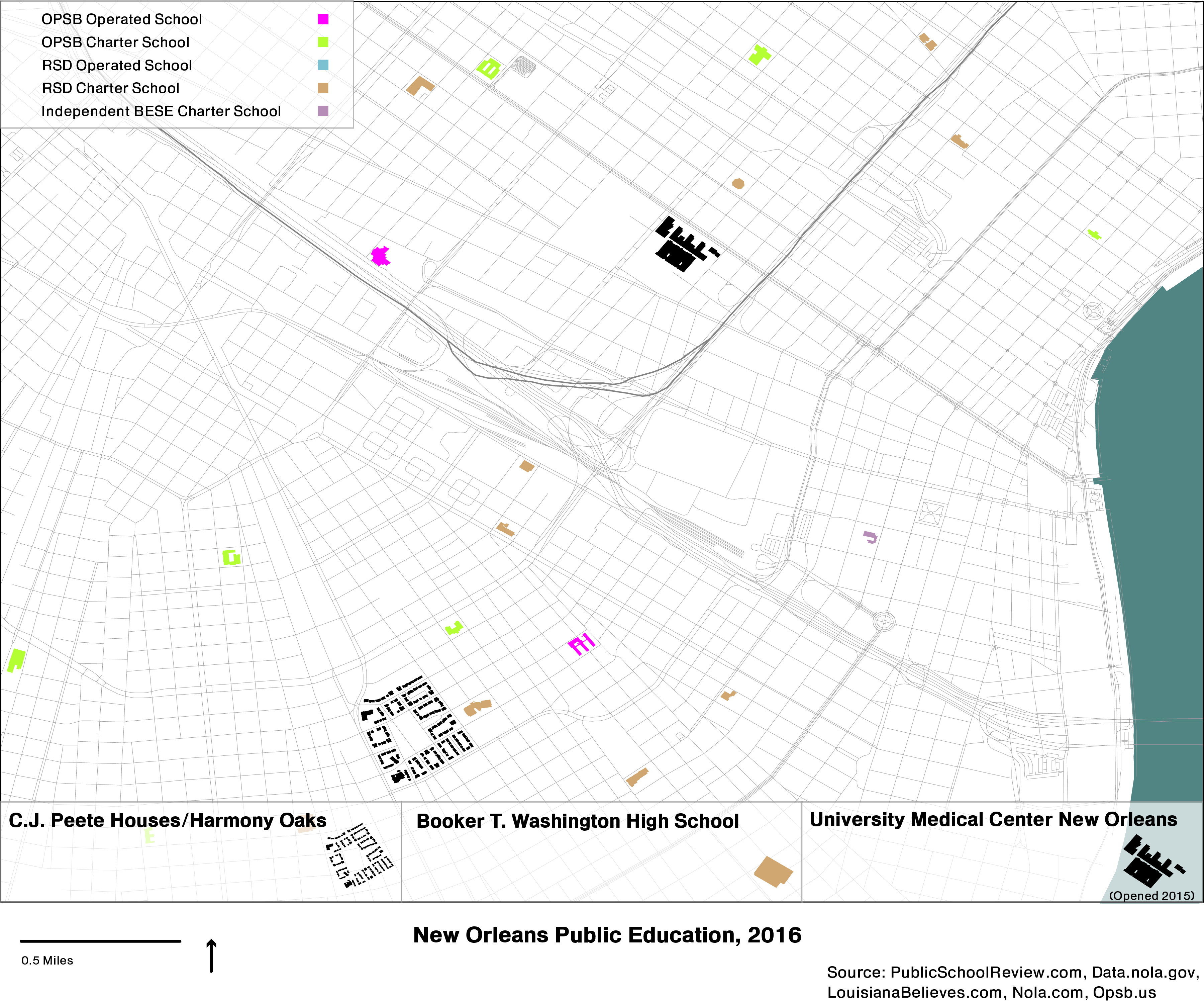
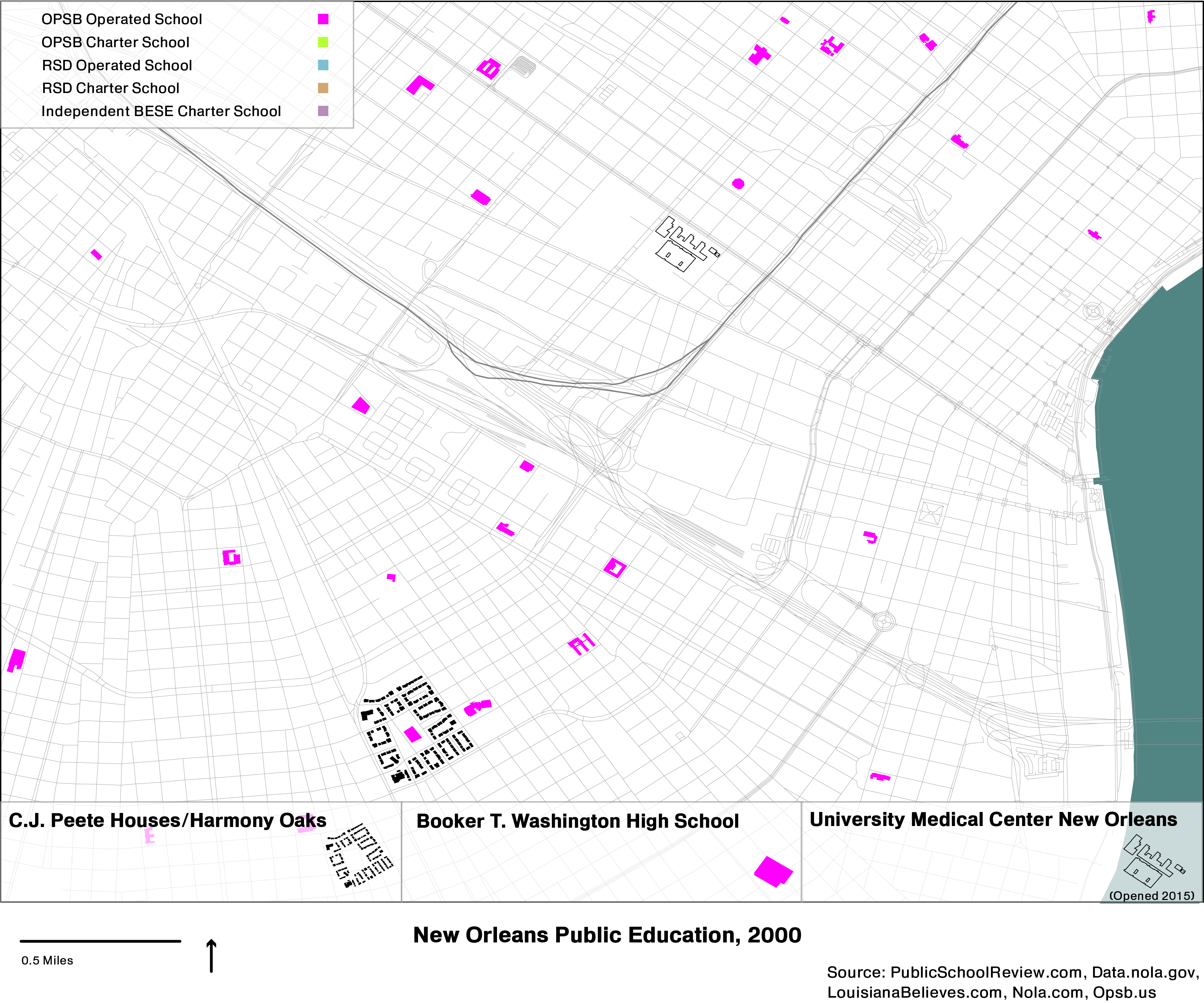
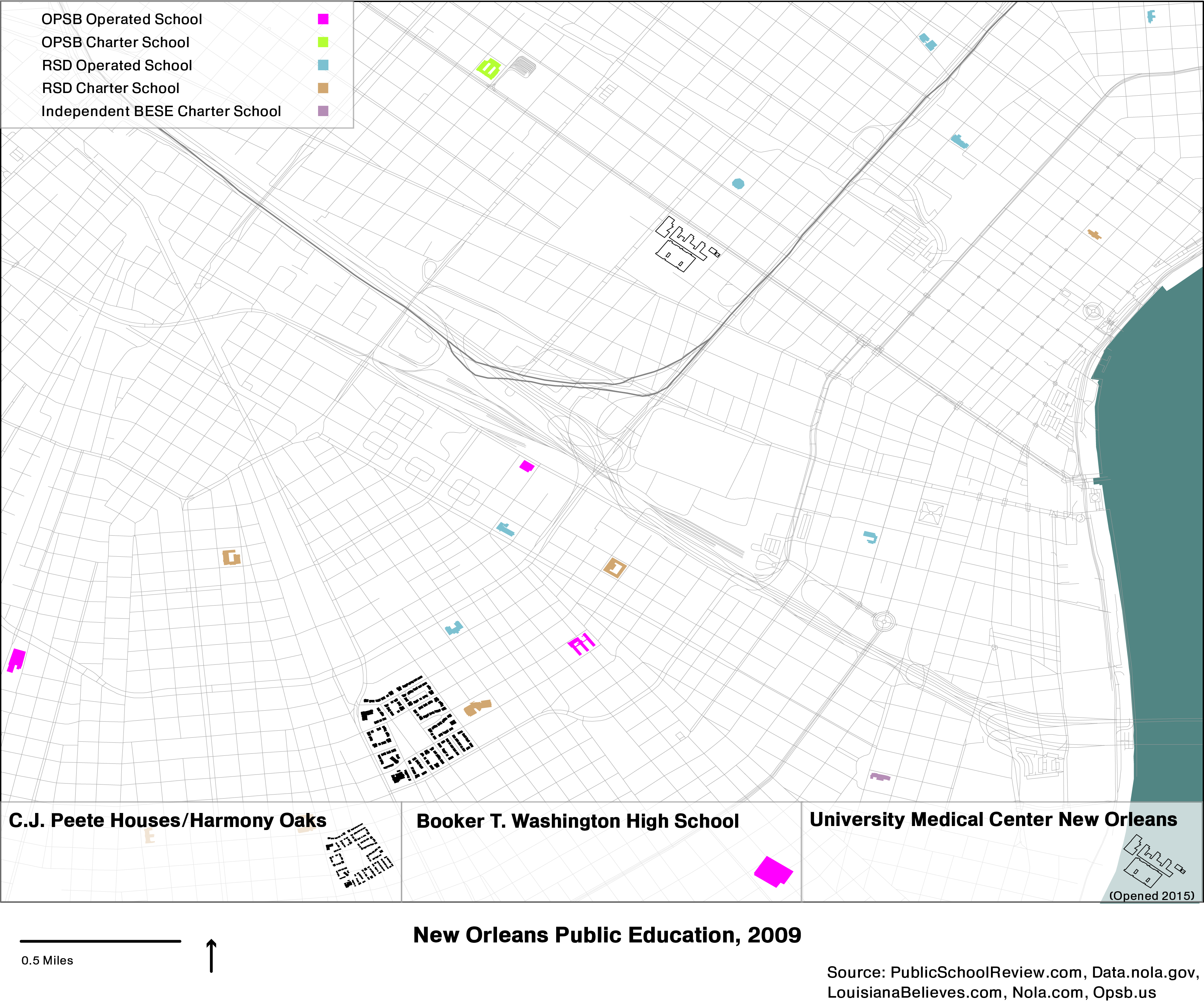
Public schools in New Orleans were largely handed over to private operators between 2000 and 2016.
Landmarks
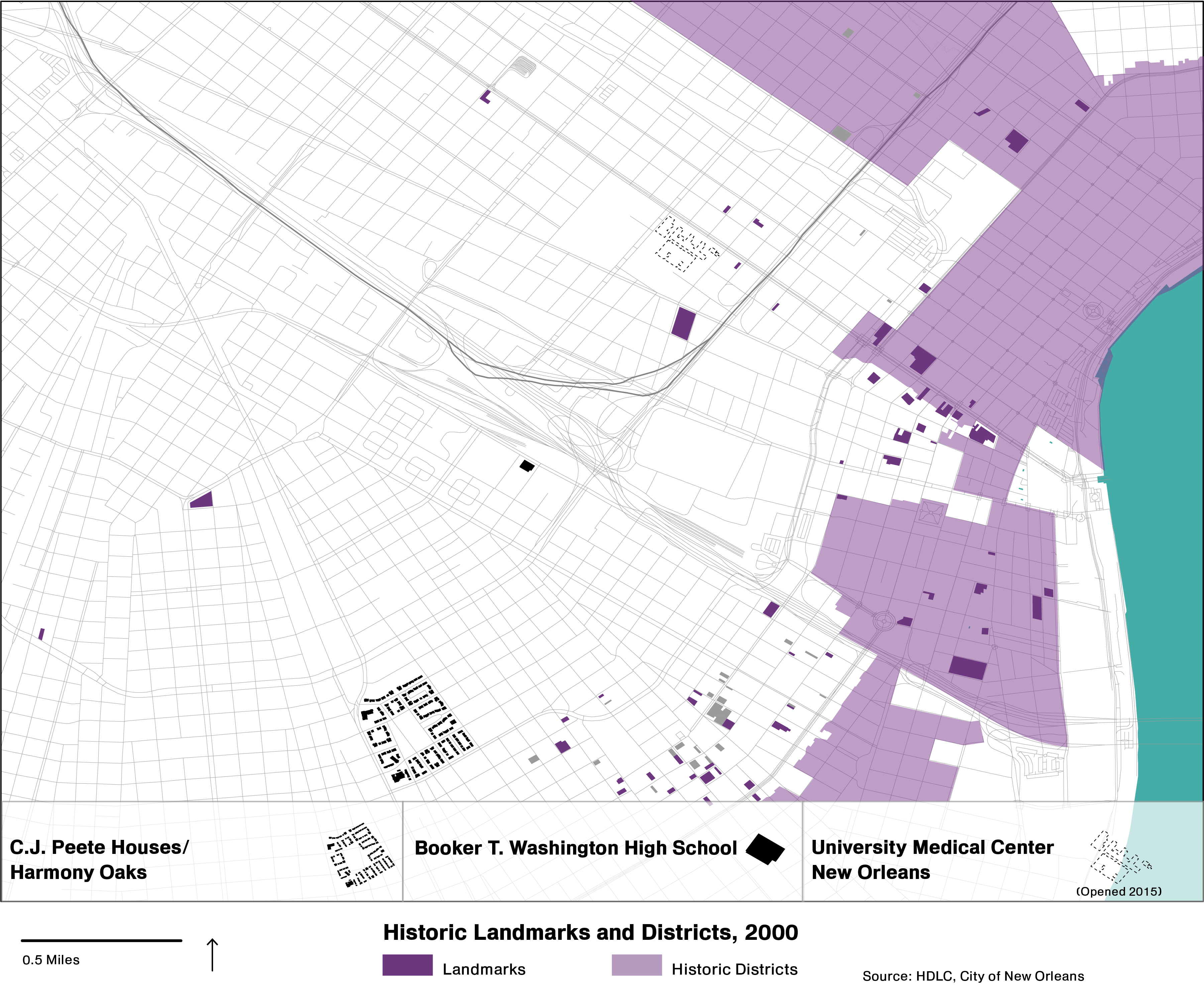
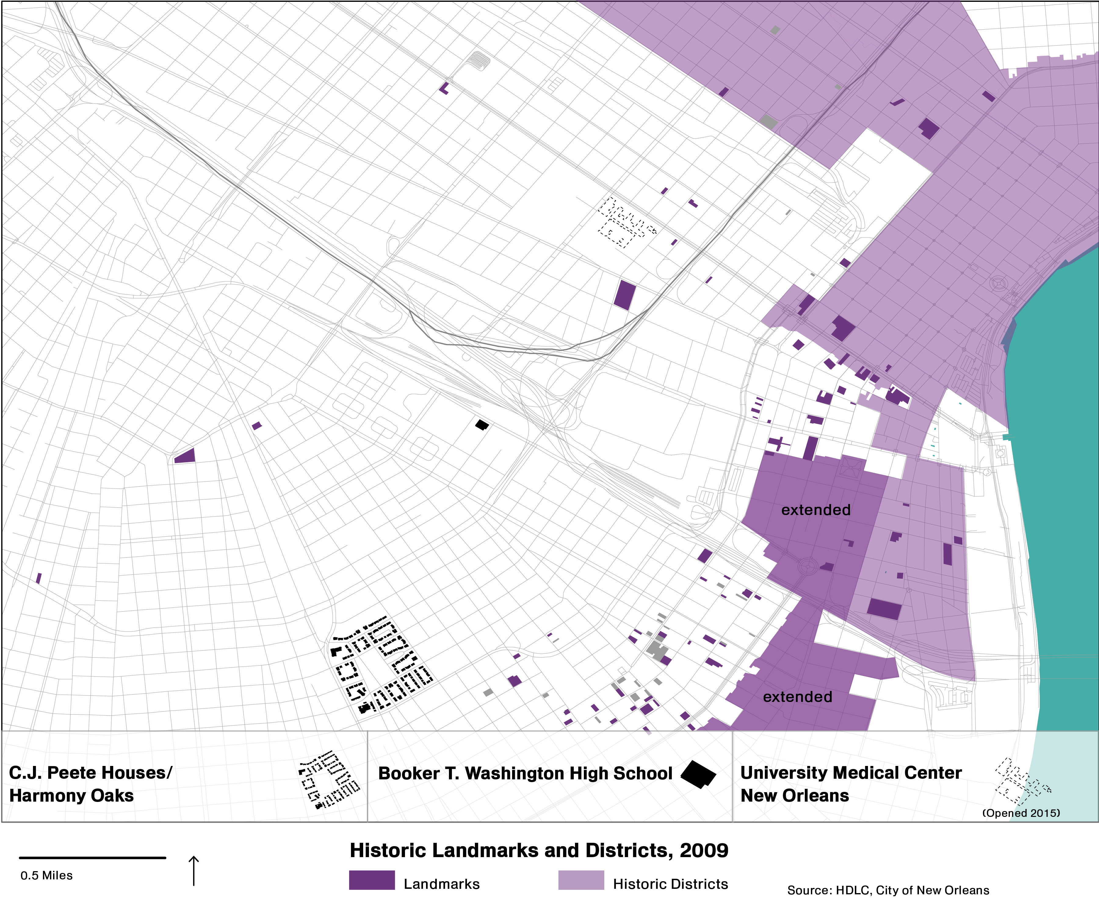
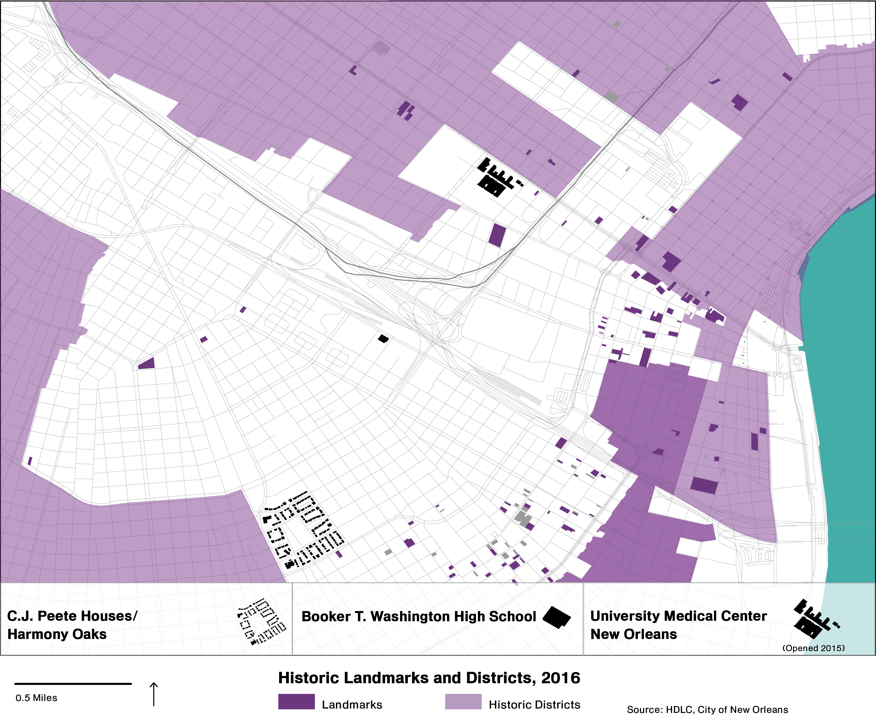
As development pressures increased between 2000 and 2016, so did pressures on areas of historical significance. Those with the political and social capital to respond with counter-pressures did so.
Hospitals
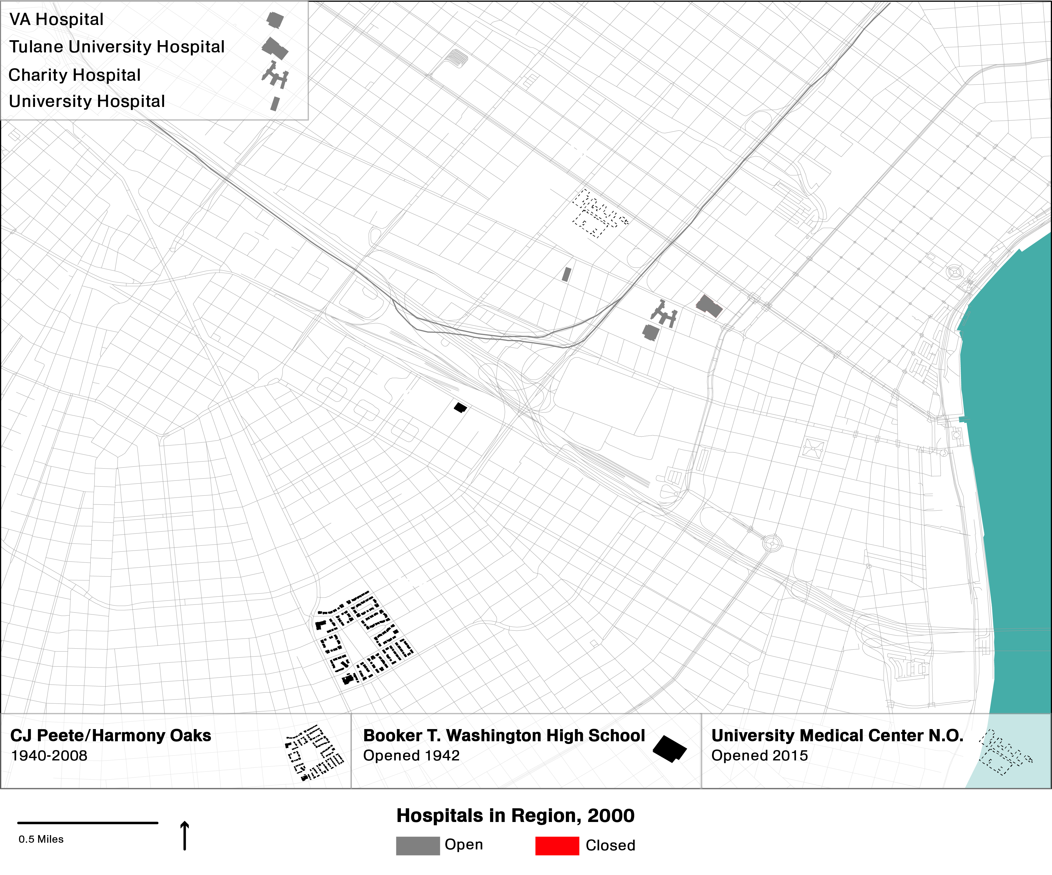
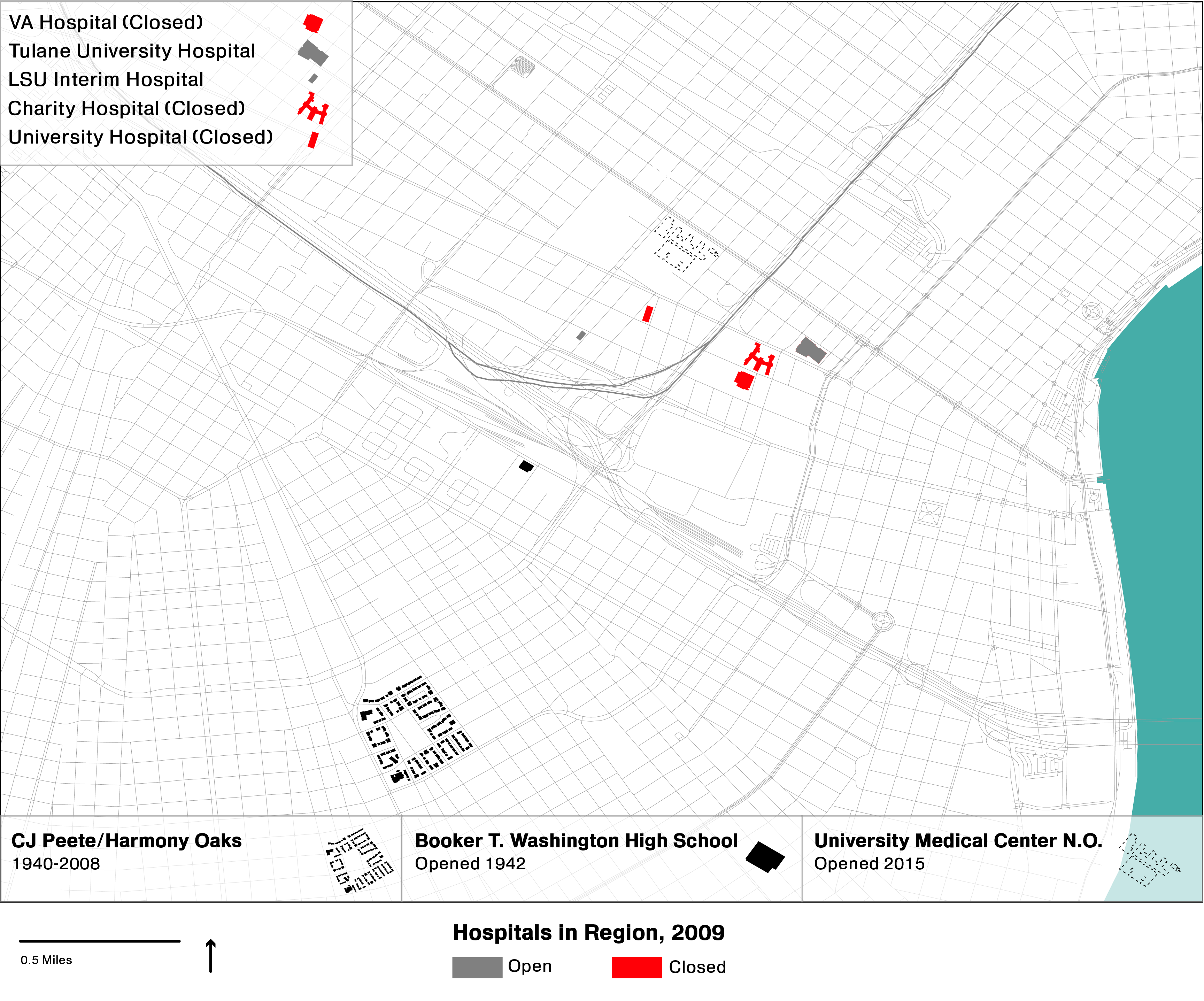
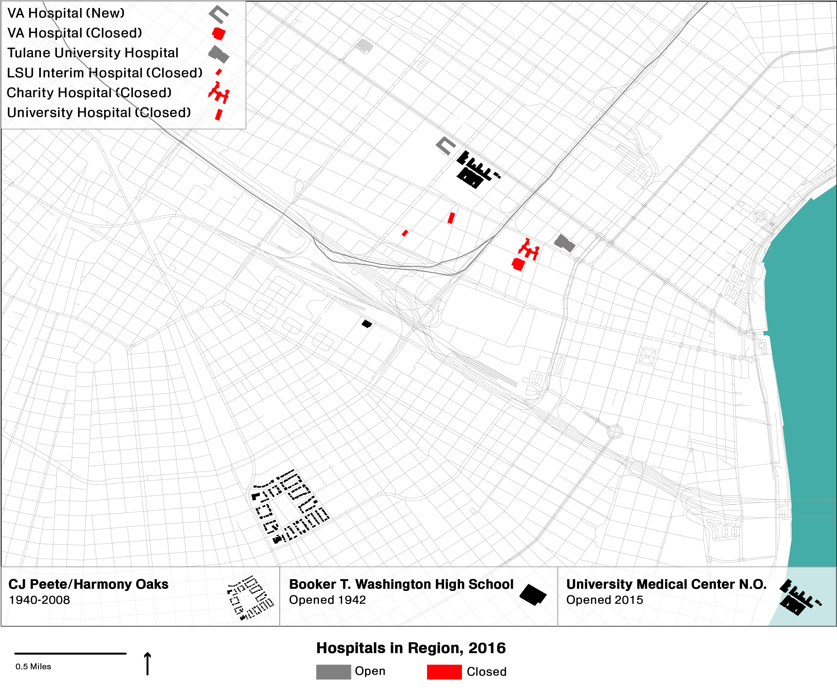
Between 2000 and 2016, all public hospitals in New Orleans were closed.
Published
Initiatives
Essay Collections
Essays
Events
Videos
